Having revealed all that Machu Picchu had in store for us and with us taking a small break to recover from the adventurous life (a few days in Lima followed by a few days now in the beachfront town of Huanchaca), let us now fill in our time just before Christmas, in San Pedro de Atacama. Let’s be clear about this — San Pedro is a tourist town. Big time. Pricey, hassly and full of gringos. But the scenery, oh the scenery, it definitely makes it worth it. It’s a high altitude desert boasting among other attractions geysers and incredible wind carved salt dunes. And it’s not really that bad of a place. But with all that in mind, we’re going to spare you lots of words about the area and just show you a bunch of pretty pictures. Because it sure is beautiful.
Breaking Down the Inca Trail: Days 3 & 4
Continued. Read the first part here.
Day 3
The rain that started the minute we got into our tents last night hasn’t let up by morning despite my numerous pleas to whatever gods will hear me, so we crawl out of our warm sleeping bags into a cold, wet day at 5:00 a.m. We have 15 km to cover, rain or shine. Behind us, Dead Woman’s Pass is covered in snow.
Ahead of us another pass waits, the Trail’s second, which we must climb 450 meters to reach. We begin the ascent, taking one short break in the rain to check out the ruins of Runkuracay, a resting spot for Machu Picchu pilgrims.
Through the pass, we descend to about the same elevation we started the day at and then climb again to the third pass. On our way, we pass through the first of two Inca Tunnels, magnificent passageways chiseled from enormous rock slabs, and walk again though cloud forest.
We also pass more Inca ruins, the most intact and impressive along the path. Lunch comes early today, and with it, the end of the rain. It’s been a wet morning, but as it is the wet season, we’ve been remarkably lucky that this is all we have encountered. Though I had my fingers crossed, I half expected to walk in the rain all day every day. Blue skies and sunshine roll in for the afternoon, which is fortunate as the hardest part of the day’s hike awaits us: the Gringo Killer. For over 2.5 hours, we must go down. Someone says there are over 2,000 stairs. I don’t count. I just know there are a lot. By the time we make camp at Winay Wayna, just before dinner, all of our knees are screaming. Since the porters are leaving us after breakfast the next morning, we have a short thank you ceremony for them, and then we all fall, literally, into our tents, absolutely exhausted.
Day 4
The benefit of yesterday’s long day is that we are as close to Machu Picchu as anyone on the Inca Trail can be. Trail regulations keep anyone from hiking before 5:30 a.m., but as soon as the clock turns, we are off, racing to the Sun Gate to get our first view of Machu Picchu. Though it’s barely dawn, the day looks clear. We can only hope it lasts as we speedwalk a couple of miles through more “Inca Flats.” As with the whole trail, it’s “no pain, no gain,” so we must make a good climb before reaching the Sun Gate. We haul ourselves up and then gape down at Machu Picchu, spread out before us.
Though many others (including plenty of people who went in the dry season) told us to expect rain, mist, or at minimum clouds covering the site, we are blessed with blue skies and sunshine. Our view is clear. A few thin clouds pass by but we have a perfect view down on the amazingly well-preserved ruins of Machu Picchu.
After snapping lots of photos, we continue down to the site for close exploration. For two hours, our guide leads us to some of the more significant sites. We then spend a few more hours exploring on our own, marveling at the perfect stonework of the temples, admiring the ingenuity of the fountains and water systems, wondering just how they managed to carve the terraces into the steepness of the mountainside, and just enjoying what truly is one of the wonders of the world.
Breaking Down the Inca Trail: Days 1 & 2
The Classic Inca Trail is a four day hike, covering 26 miles. Here’s how it broke down for us.
Day 1
Around 5:30 a.m., we board a bus in Cusco and travel 1.5 hours to Ollantaytambo, where we have a chance to eat breakfast and grab any last minute items we forgot. We then continue on to the start of the Inca Trail, where we pass through the official checkpoint, take a group photo, and begin our day’s 12 kilometers of hiking.
This is the easiest day and the hiking takes place along what is referred to as the “Inca Flat.” Apparently Peruvians have a very different idea of flat than I do, because we are pretty much going uphill most of the time. The ascent isn’t extreme, but we do gain over 1,500 feet during the course of the day, with one rather steep section. A good introduction, it gets our lungs burning and our hearts panting.
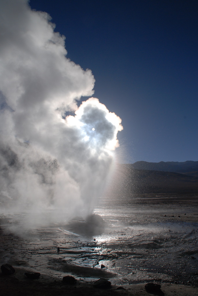
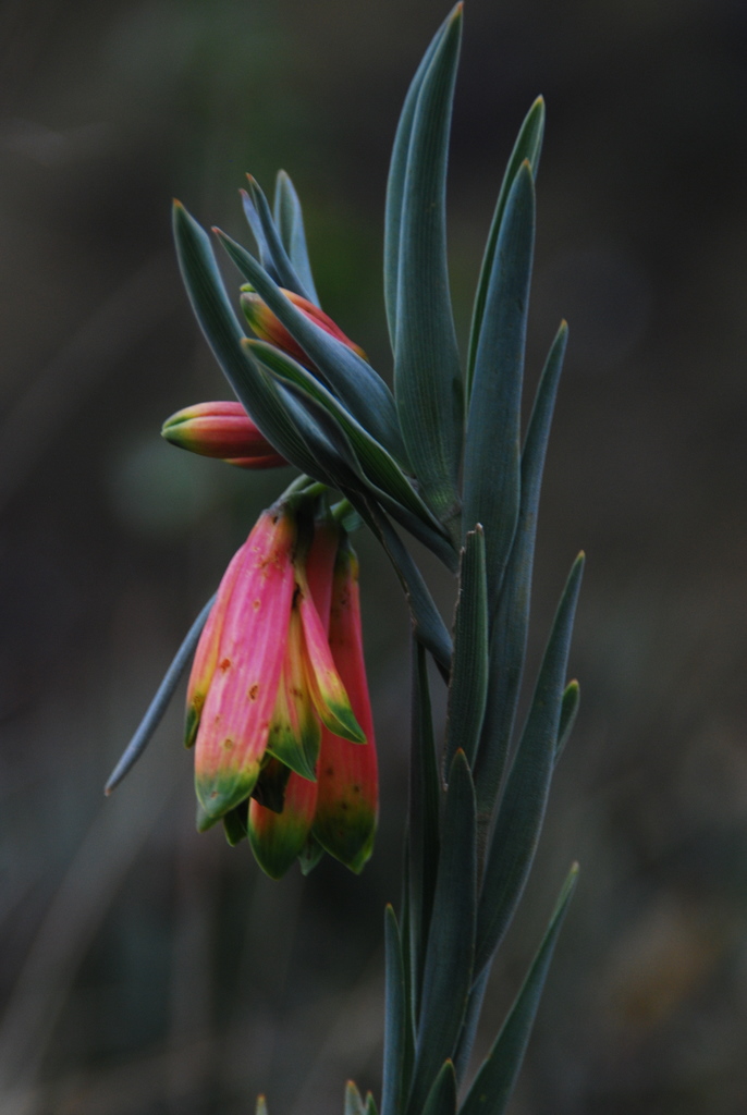
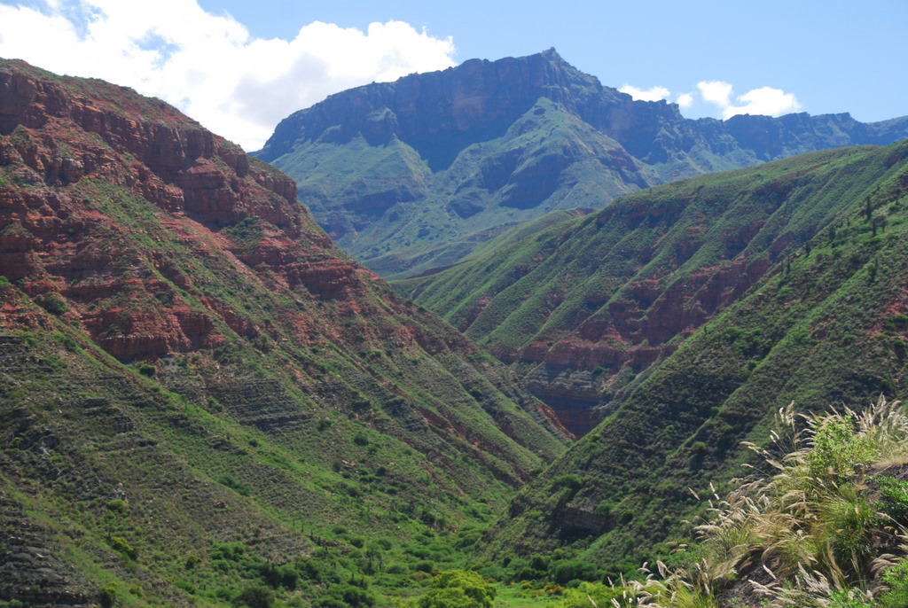
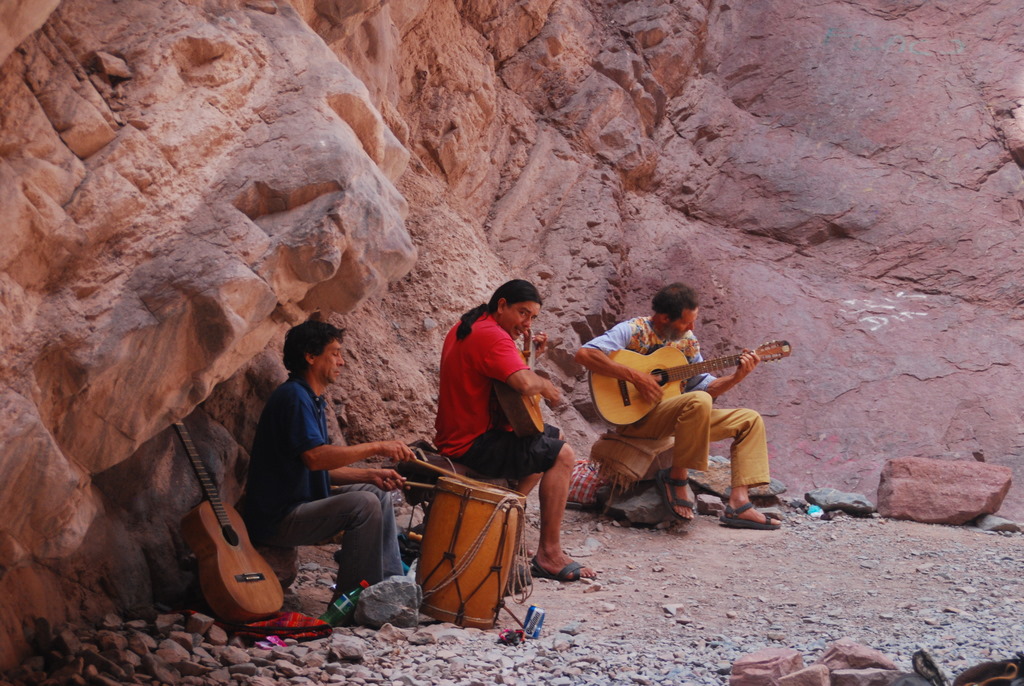
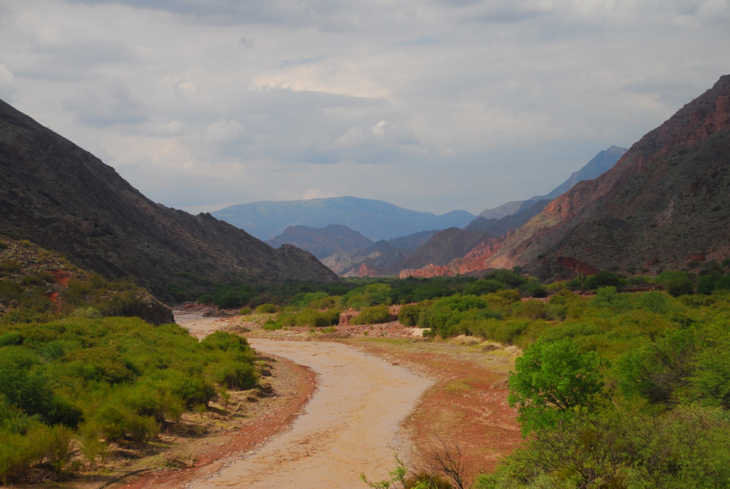
During the morning, we follow the course of the Urubamba River, stopping to allow locals with their llamas to pass, to learn about the use of native plants, and to see our first set of ruins.
Lunch comes late, at around 2:30, and it’s a lot more food than we are expecting, a lot more food than I usually like to eat when I hike. Two more hours of uphill walking leads us to our first camp, in the rural setting of Wayllabamba. After another multi-course meal, we all fall into our tents, exhausted after a long day of walking and so very thankful for the porters who have everything so perfectly set up when we arrive. They are absolutely incredible, carrying giant packs and practically running the trail as we pant along at a snail’s pace. I’m in awe.
Day 2
The crow of a rooster wakes us before our official 5:30 a.m. wake-up time. Another 12 km day awaits us, but this one promises to be much more difficult as it involves going up, up, up, up, up, and up. For five hours, we haul ourselves up to the aptly-named Dead Woman’s Pass. We break it into three sections; the first section is a short one that involves only one hour of hiking before a short stop where the group, all moving at different paces, regroups.
The next stretch is two hours and involves climbing step after step after step. Luckily, the climb is through beautiful cloud forest, the waterfalls and flowers and hummingbirds inspiring us to continue putting one foot in front of another.
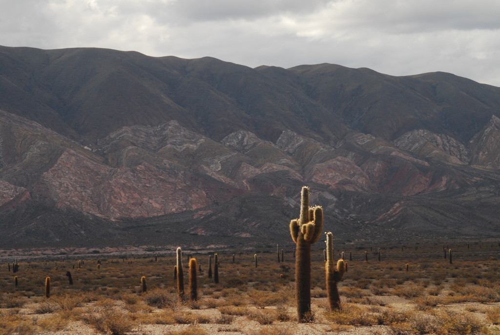
A mini-lunch of sandwiches, popcorn, and tea awaits us at the next break, as does the first real rain of our trip. With two hours of climbing in front of us, we can’t wait it out, so we set out in the rain, which fortunately doesn’t last more than an hour. We’ve now passed beyond the tree line and must clamber up a dirt path, the scrub bushes on the side of the path serving as mini-goals—just 10 more yards and then I can catch my breath.
The final ascent to the 4,200 meter pass, the highest elevation on the trail, involves a steep staircase.
We drag ourselves up it, and then from the top, look down in awe at the distance we have covered.
Unfortunately, we can’t bask in the glory for long as the hard work isn’t over. To get to the Paqaymayu campsite, the day’s destination, we now must descend 700 meters. Thanks to the day’s rains, the stone steps are slippery and in parts it seems like we’re walking down a waterfall. It’s slow going, but thanks to the day’s early start, we arrive in camp in early afternoon, where we pass the rest of the day eating (or at least that’s how it seems with lunch, tea, and dinner following one after another).
To Be Continued…
(Sorry, I hate those endings too, but my connection is slow right now making the illustrating of the text with photos brutal. Plus I have an early morning flight back to Lima, so this will have to do for now. Check back Friday for the final installment.)
Machu Picchu: Conquered
We survived. My brother Gregory, Jeff, and I have made our pilgrimage to Machu Picchu, the sacred site of the Quechua people* and returned to Cusco, more or less intact.
This past summer, Jeff and I hiked somewhere around 500 miles. More than once, we hiked over 20 miles in one day, and then woke up the next day to do it again. I wouldn’t say it was fun and I wouldn’t say it was easy, but it wasn’t killer. The hike to Machu Picchu by way of the classic Inca Trail is about 26 miles long, and it’s done over the course of four days. Sounds not too bad, right?
Ha. Think again. The Inca Trail is hard. This is no stroll in the park, no walk in the woods. This is a long, hard haul at extremely high elevation. You begin at 2,600 meters. (That’s 8,528 feet for those of you who can’t figure out the metric system.) By the first night, you are at 3,100 meters (10,137 feet). That’s twice the elevation of Denver, which many of us Americans consider to be high and hard on the lungs. On the second day, you ascend to 4,200 meters (13,776 feet). You go up a lot. But it’s not just uphill. You also go downhill–hard and fast–and then go back uphill all over again. The ground is rough, much of it paved with uneven stones. Sometimes the only thing on the side of the trail is a steep drop-off. And being the rainy season, creeks spill over the trail, stones become slippery, and rivers rage. The Inca Trail is not for the faint of heart.
But it’s difficulties are balanced by its rewards. On the first day, you pass local people in traditional dress, working the land and living the way they have for hundreds of years.
Every day magnificent scenery surrounds you—sheer mountains that seem to rise straight from the earth, snow-capped peaks, waterfalls, cloud forest jungle—and because it’s the rainy season thousands of orchids, bromelids, and other flowers.
And you don’t have to wait until you get to Machu Picchu to see Incan ruins, as there are many ruins along the way: small sites that served as resting spots, larger sites that astronomers used to predict the best times for planting and harvest, and a variety of other impressive ruins where pilgrims to Machu Picchu stopped five hundred years ago.
All in all, we had a fabulous time. Our group of 12—aside from an unfortunately whiny Canadian couple—was good, our guides were knowledgeable and encouraging, the food was plentiful and pretty tasty, the tents warm, the porters amazing, and the weather surprisingly good for the heart of rainy season. And Machu Picchu, well, it was definitely worth the work.
Check back tomorrow for a day by day break-down of the trip, along with some more photos. And yes, we know that we have not yet posted anything about our first few adventures prior to the Inca Trail. We will take some time and rewind back to that after we enjoy our last few days with Gregory.
*It’s incorrect to refer to the people as Incas. There was only one Inca—the king.
Happy New Year!
Happy New Year to everybody out there! We passed it in Cuzco, although with no TV to watch the ball drop on, we may have celebrated a few minutes off. The pouring rain kept us inside and the cold kept us under our covers, so it was a calm and quiet one for us here. Resolutions of less overanalyzing have already been made and broken. But you can’t go wrong starting a new year by hiking the Inca Trail, which we start bright and early tomorrow morning. Since we haven’t had time to line up posts while we’re out, you’ll just have to manage without us till we get back January 6th.
While we’re gone, we’d love to hear how friends and family rang in the new year. We wish all of you a happy and prosperous new year!
A Visitor!
We’ve been traveling for almost three months now. This means that we’ve spent approximately the last 2000 hours together, with one another being our only consistent support in our grand endeavor. And honestly, while that brings us closer and all that, when you do everything together and see everything together and notice everything together and are removed from the pace of everyday life together, you run out of things to talk about. Everything we take in about the world happens at the same time. Our conversations often amount to “hmm, did you see that, that was weird” … “huh, yeah.” Sure, there’s an awful lot of conversation about what to do next, what we just did, what do you want to eat, and so on. But there’s also a lot of comfortable silence these days.
So I think we’re both a little excited to have someone else to talk to. Get filled in on all the weird little things that make the news. Someone to update me on the football world. Theresa’s brother Greg arrives tonight to join us in exploring Lima, Nazca and Cuzco. Since it’s all got to happen in ten days, it will be a flurry of activity and we may not be terribly active here. Instead, we may be too busy talking.
Chile Summary Now Online
We’ve added a new page to our Country Summaries; check it out for a review of our time in Chile. Because we have hundreds and hundreds (maybe thousands) of photos of Chile to sort through, we haven’t yet uploaded them but will (hopefully) soon. We’ll let you know when they’re up. We also don’t have the budget page up yet, but we’re planning to do some serious arithmetic on our upcoming bus ride to Lima and will post that info as soon as possible.
As for what we’re up to now. We’re leaving the Chilean border and beach town of Arica tomorrow morning to cross into Peru and then hop an 18 hour bus up to the capital city of Lima, where we will meet my brother Gregory on the 28th. Then it’s adventures in Nazca, Cusco, and who knows where else. Stay tuned.
A Makeshift Chilean Christmas
It came without brisket, it came without tags
It came without 19 types of cookies, without a tree, wrapped boxes and bags
But somehow it came, it came just the same.
Okay, I lie. It didn’t come just the same. I didn’t get my annual family viewing of the animated version of “How the Grinch Stole Christmas.” I didn’t get a bedhead family photo on the stairs Christmas morning. I didn’t get the loud exclamations from my brothers over every gift they get as though they are 5 years old and not 20, 23, and 26. I didn’t get my Christmas Eve dinner of brisket, mashed potatoes, green beans, and chocolate pie. I didn’t get to hear the same Dowell family stories that I’ve heard pretty much every year of my life on Christmas Eve. I didn’t get the au gratin potatoes, jelly jokes, and all-family photos at the Zimmerman Christmas day gathering. I didn’t get to indulge in every type of homemade cookie known to man or participate in impromptu family sing-alongs to Christmas songs.
So yes, Christmas came, but it didn’t come at all the same. But we did our best with what we had. We tucked away the little green foam Christmas trees that came with one of our bus boxed lunches. We bought a tiny nativity scene that depicts the Holy Family as indigenous Andean people. And we browsed the markets until we found red woolen socks that would serve as stockings. Then we got a nice room in a nice hotel (comfortable bed! TV! wifi! jacuzzi tub!) and decorated our desk. And guess what? Santa found us even though we’re tucked away in a nowhere town in northern Chile.
What did he bring us you ask? Well, we got a bag of delicious Rainier cherries, a mini lemon pie, a brownie, cookies and a candy bar, cupcakes that look like Hostess cupcakes but are called Penguinos (penguins), a pair of earrings (for me, not Jeff), and penguin and llama finger puppets. Jealous, yes?
I understand. Because hey, I’m jealous too. Though we made the best of the holiday, I think we both agree that Christmas without family just isn’t the same. Whoever it was that said there’s no place like home for the holidays, well (s)he knew what (s)he was talking about. Next year, I can tell you that no matter where life leads us post-RTW trip, we’ll be home for Christmas…and not just in our dreams.
Merry Christmas, everyone, wherever you are.
A Privileged Way of Thinking
As we made our way around the Valles Calchaquies, from Salta to Cachi, Cachi to Cafayate, Cafayate back to Salta, most of what we seemed to see was the vast emptiness of a difficult but stunning landscape. There were a few small established towns, places with a market and a restaurant, running water and electricity, and in the larger ones maybe even a bank and a gas station. As we explored these larger towns, I’d find myself wondering what brought people here, why anyone would choose to try to settle in such a place. I imagine the majority of the people that live there now live there because their parents lived there and their grandparents before them. It’s home. But what about the first settlers?
What really struck me, however, wasn’t the towns. They were livable, certainly. Many were beautiful in their own way. They were the perfect spot, in fact, for people who prefer their independence, their space. What struck me most were the places between towns where people seemed to live. More frequently that I could have imagined, where I could see nothing but cacti and towering rock formations, people would hop off the bus, their bags of goods from town in hand. I’d try to watch them to see where they were going, but our bus would always zoom on before I could even spot the faintest outline of something I’d consider a destination.
And as we bumped around the loop from Cachi to Cafayate on gravel roads hardly suitable for driving, I’d look out the window of the rental car we were riding in and see small houses near absolutely nothing. They were mainly straw and adobe huts, unfinished, absolutely basic. I’d marvel at them and then, without fail the first question my brain would form would be “What do these people do out here?”
As a resident of a highly developed nation, I have become practically programmed to expect that everyone “does” something. We are lawyers, accountants, doctors, writers, secretaries, bartenders, teachers, researchers, CEOs, plumbers, electricians, sales people. When travelers meet each other, within the early reaches of a conversation, the question of “What do you do?” almost always comes up. It is how we define ourselves and understand others.
But for many people in the world the luxury of “doing” something doesn’t exist. They don’t live in a world that tells them they can be anything they want to be, that they can do anything they put their mind to. Instead what they “do” is survive. They plant crops and tend crops and harvest crops, in the hopes that they have enough to feed their families. They maintain their homes, trying literally to keep a roof over their heads. They tend to livestock. They mind their children. They are often farmer, teacher, construction worker, doctor, and firefighter all in one. But if you asked them what they do, they’d look at you like you’re an alien. What do they do? They live, the best way they know how.
The American Southwest Meets Sonoma in Argentina
I’m not 100% sure what most people think when they think of Argentina—perhaps its the European style of Buenos Aires, the sizzle of tango, the melt-in-your-mouth taste of steak, the wilds of Patagonia, or the gauchos of the pampas—but I’m pretty sure it’s probably not cacti. In northern Argentina, however, that’s exactly what you’ll find: huge cacti and marvelous rock formations. And oh yeah, vineyards too.
Lying west and south of the major city of Salta, the Valles Calchaquies is a collection of towns (mainly tiny) at approximately the altitude of Denver in a landscape that looks like that of the American southwest. A road circuits through the towns, providing a splendid diversion for a couple of days.
We left Salta Tuesday morning on a bus that reminded us that as we move north we’re leaving behind the luxury of highly developed Chile and Argentina for the more basic offerings of the rest of South America. After stopping for about every single person on the side of the road as well as some bananas and a watermelon, we made it through the seemingly never ending suburbs of Salta and began to wind and wind and wind and climb and climb and climb our way through the Cuesta del Obsipo and the Parque Nacional Los Cardones. The narrow gravel road weaved through valleys surrounded by imposing scrubby cliffs.
Upon reaching altitude, the road leveled out and we revved our way through a sandy desertscape of giant cacti.
After 5.5 hours on this luxury liner, we pulled into the town of Cachi, which, though one of the largest towns in the Valles Calchaquies, is nothing more than a central plaza and about a block on each side. We set ourselves up in the hostel and then covered the town from side to side, end to end. This wasn’t our biggest accomplishment, however. No, our biggest accomplishment was securing a ride for the next day. Though we’d come on bus to Cachi, we weren’t going to be able to rely on the bus to get all the way around the loop. For some strange reason, 39 km of the loop isn’t accessible by public transportation. If you want to cover that stretch, you have two choices: walk or hitch. We chose hitch, but not the standing on the side of the road, thumb in the wind type of hitching. We chose instead the ask the other travelers if they have a car and want to give you a ride type of hitching. We got lucky and the first people we asked, a British couple, offered to take us not just the 39 km not covered by bus, but all the way around to the other main town, Cafayate. Great success!
Before hopping in the car with our new friends, we made a morning visit to the local church and then trekked up to the hilltop cemetery, which looked like something straight from the wild, wild west.
The spectacular scenery continued as we began our bumpy ride around the loop. Huge red rock formations jutted up from the ground, a couple of prairie dogs played roadside, and a few tiny, tiny towns existed seemingly in the middle of nowhere. We stopped time after time to take photos, never quite capturing the magnificence of it all.
A welcome stretch of paved road led us into Cafayate, which seemed like a big city thanks to the fact that it had a few blocks in each direction from the plaza. It’s also an important city, as it is, after Mendoza, the second largest wine producing region in Argentina. And so, after surviving a torrential nighttime rainstorm that turned the roads into rivers, we took advantage of the sunny day and the many nearby wineries to sample the local goods. The specialty of this area is not the malbecs and cabernet sauvignons that most people associate with Argentina, but a dry white wine called torrontes. It’s actually quite good, and that’s coming from a red wine devotee. Visits to three wineries plus a goat cheese farm (because what goes better with wine than cheese?) filled our day.
On our final day in the Valles Calchaquies, we hopped an afternoon bus, and then after 46 km asked the driver to drop us off in the seeming middle of nowhere. He obliged, and we spent the next five hours getting up close and personal with the wacky rock formations, including named ones such as the amphitheatre and the devil’s throat.
We managed to successfully hail down the evening bus and then spent the next few hours rocking and rolling back to Salta on a bus that seemed to have no shocks or struts. It was a treat I tell you, but not as much as the delicious steak dinner we had to cap off the night.
The Valles Calchaquies certainly might not be archetypical Argentina, but both Jeff and I agree that it currently holds the title for our favorite part of Argentina. Once we return in March for Buenos Aires, Iguazu Falls, and Mendoza—probably the most popular areas of this country—we’ll let you know if the title still holds.
You must be logged in to post a comment.